Air to ground photo survey images using Kodak Aerochrome film
Pre-digital age photographs made decades ago using Kodak Aerochrome (a color infrared reversal film) from a height of approx 2000ft. These days such civilian remote sensing is accomplished using digital equipment and satellite technology.
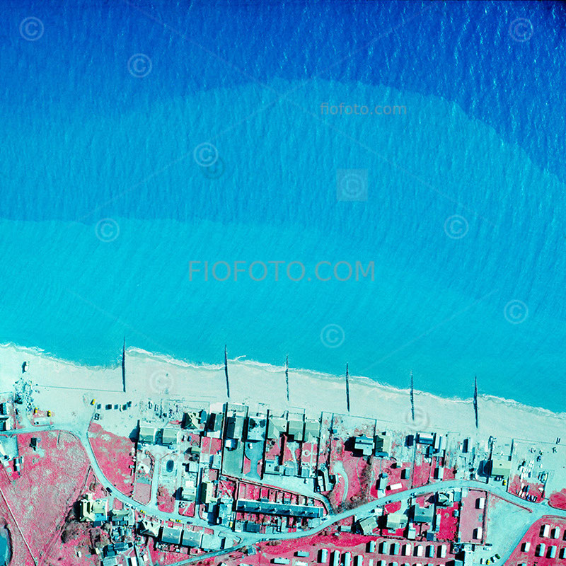
1. Beach features and littoral zone along the coastline near Worthing, West Sussex
Water absorbs near-infrared (NIR) wavelengths almost instantly—within the first few inches of the surface. Because NIR light cannot penetrate water, it cannot bounce off the seafloor to show depth. However, Kodak Aerochrome was a multi-layered film that also captured visible green and red light. It is the behavior of these visible wavelengths that makes it possible to map shallow coastal depths (bathymetry).
By analyzing the gradient from bright cyan to absolute black, researchers could effectively map shallow coastal profiles, underwater sand banks, and safe navigation channels close to the beach.
Water Depth (Bathymetry) and Color Gradients
Because a yellow filter blocked blue light, the film relied on green and red light to pierce the water.
Very Shallow Water (0 to 2 meters): Green and red light easily penetrate this depth and bounce off bright beach sand. On the film, the combination of light creates a distinct light green or cyan tint. Sandbars, shallow reefs, and shorelines stand out brightly.
Intermediate Depth (2 to 10+ meters): As the water gets deeper, it gradually absorbs the red light, and eventually the green light. The bright cyan fades into a deep blue, and finally into solid black where the water becomes too deep for any light to bounce back to the camera.
By analyzing the gradient from bright cyan to absolute black, researchers could effectively map shallow coastal profiles, underwater sand banks, and safe navigation channels close to the beach.
So, while infrared film was technically “blind” to the deep ocean, its visible-light layers made it an incredibly precise tool for charting shallow coastal zones, underwater habitats, and the mixing zones where the land meets the sea.
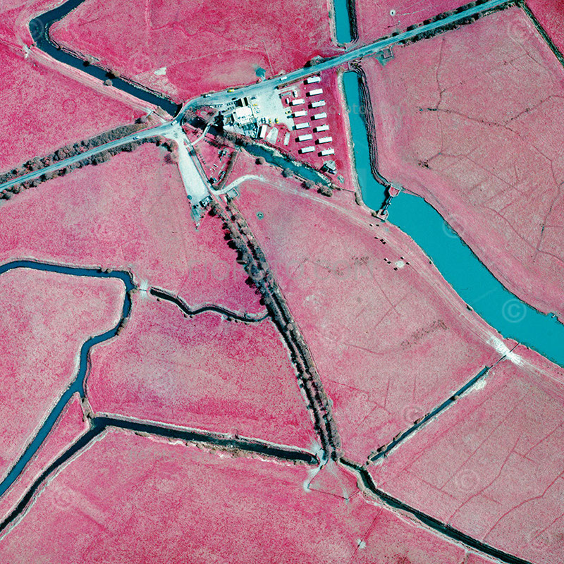
2. Farmland and canal waterways in the rural landscape of West Sussex, England, UK
In agriculture, aerial surveys would fly systematic grid patterns over farmlands to provide farmers and researchers with “early warning” diagnostic maps enabling early disease and pest detection.
When a plant becomes stressed by a disease or pest infestation, its internal leaf structure begins to collapse, causing it to lose its ability to reflect near-infrared light. This happened days or weeks before the leaves actually turned yellow or brown to the naked eye. Aerial surveys allowed farmers to isolate outbreaks (like potato blight or aphid infestations) before they spread to the whole field.
Irrigation and Water Stress Management: Water-stressed crops lose their NIR reflectivity quickly. Infrared photography allowed large-scale operations to identify failing irrigation pivots, blocked lines, or areas with poor water-retention in the soil, appearing as distinct, off-color patches in a sea of bright red.
Other uses for this tool included forestry and environmental management, hydrology and wetlands mapping.
Infrared film had a unique relationship with water that made it invaluable for mapping aquatic environments. Clean, clear water absorbs infrared radiation almost completely. On the film, water appears completely black. This created a stark, razor-sharp contrast against the bright pink of shoreline vegetation. Environmental scientists used this to precisely map tidal marshes, floodplains, and changing river channels.
BUY A PRINT