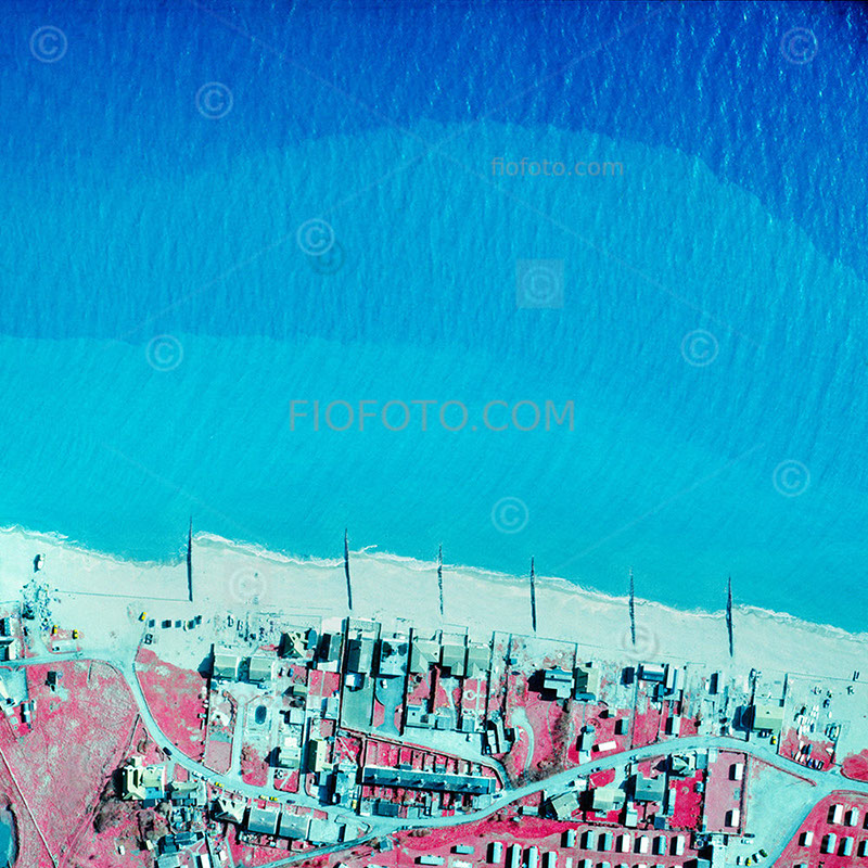
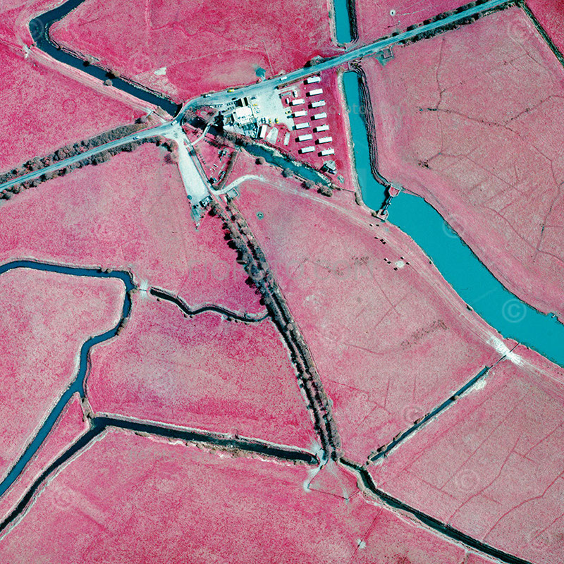
Skip to Main Content
fiofoto | peter john

Peter John Field Journals

  • ABOUT
    • Terms & Conditions
    • Privacy Policy
    • Copyright & Licensing
  • CONTACT
  • RECORDS
    • Gibbergunyah
    • High Place | Bowral
      • A Last Parade
    • Records | Picture Posts
    • Series Index
  • PRINTS
    • SHOP | BUY A PRINT
  • LOGIN
  • ABOUT
    • Terms & Conditions
    • Privacy Policy
    • Copyright & Licensing
  • CONTACT
  • RECORDS
    • Gibbergunyah
    • High Place | Bowral
      • A Last Parade
    • Records | Picture Posts
    • Series Index
  • PRINTS
    • SHOP | BUY A PRINT
  • LOGIN
4 Oct 2025

Record #122

by fiofoto | posted in: From the Archive | 0
  • Aerial infra-red photograph of beach and littoral zone. Worthing area, West Sussex, England, UK.
  • Aerial infra-red photograph of farmland and canal waterways in West Sussex, England, UK.
Infra-red aerial photography, air to ground survey images
  • Beach features and littoral zone along the coastline near Worthing, West Sussex
  • Farmland and canal waterways in the rural landscape of West Sussex, England, UK
BUY A PRINT

Related

landscape, infra red, aerial photo
Previous Post
Next Post

  • Bluesky
  • Shop
  • T&C
  • Index
  • Login

© 1999 - 2025 fiofoto.com & Peter John, All Rights Reserved.

  • Login
  • Sign Up
Forgot Password?
Lost your password? Please enter your username or email address. You will receive a link to create a new password via email.
body::-webkit-scrollbar { width: 7px; }body::-webkit-scrollbar-track { border-radius: 10px; background: #f0f0f0; }body::-webkit-scrollbar-thumb { border-radius: 50px; background: #dfdbdb }